India And The US Launch Landmark Earth Observation Mission
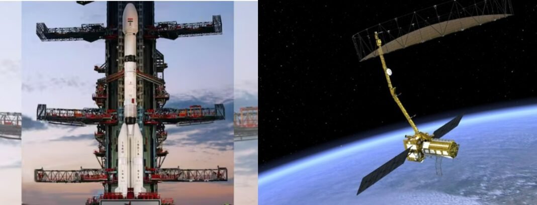
The Indian Space Research Organisation (ISRO), in collaboration with NASA, successfully launched the NASA-ISRO Synthetic Aperture Radar (NISAR) satellite today at 17:40 IST from the Satish Dhawan Space Centre in Sriharikota, Andhra Pradesh. This joint mission marks a milestone in Indo-US space cooperation and sets a new standard for global Earth observation capabilities.
NISAR, a highly advanced Earth-observing satellite, has been more than a decade in the making and represents a joint investment of over USD 1.5 billion. Designed to track changes in Earth’s surface with exceptional precision, the satellite carries a unique dual-band Synthetic Aperture Radar system, operating in both L- and S-band frequencies. The system will enable high-resolution and wide-swath imaging across diverse terrains and environments.
First GSLV Launch into Sun-Synchronous Orbit
The 2,392-kg NISAR satellite was launched aboard the GSLV-F16 rocket—an unusual choice, as Sun-Synchronous Polar Orbits are typically served by the PSLV series. This marks the first time a GSLV has been used for such a mission, highlighting ISRO’s expanding capabilities in launch vehicle versatility.
Once deployed, NISAR will orbit the Earth every 97 minutes in a Sun-synchronous path, capturing detailed radar imagery of land masses, glaciers, ocean surfaces, and sea ice every 12 days. The satellite’s primary mission life is five years, during which it will continuously deliver valuable data for scientific, environmental, and disaster management applications.
Global Access to High-Quality Radar Data
One of NISAR’s defining features is its open-access data policy. All imagery and observational data will be made freely available within one to two days after acquisition. In times of crisis, such as natural disasters, near real-time access will be provided. This unprecedented level of data transparency is expected to empower researchers, governments, and disaster response agencies, especially in developing nations.
“This mission is not just a technological feat—it’s a statement of scientific diplomacy,” said Union Minister for Science and Technology, Dr. Jitendra Singh. “It underlines what two democratic nations can achieve when united by a vision of global welfare and environmental responsibility.”
Pioneering Scientific and Humanitarian Applications
NISAR’s primary scientific goals include monitoring land and ice deformation, studying ecosystems, and tracking shifts in oceanic regions. The satellite’s precision instruments are capable of detecting millimeter-scale changes in the Earth’s crust, making it a powerful tool for monitoring earthquakes, volcanic activity, and landslides. Additionally, the radar can be employed to map crop patterns, assess soil moisture, monitor shorelines, classify sea ice, and even detect ships at sea.
The first 90 days post-launch will be dedicated to In-Orbit Checkout (IOC), during which all onboard systems will be calibrated and tested to prepare for full-scale operations.
Strengthening Global Partnerships in Space
The NISAR mission has been hailed as a defining moment in India’s international space collaborations. It showcases the growing trust and strategic alignment between India and the United States in high-technology sectors. More broadly, it signals India’s evolution as a major player in the global space community, with the capacity to contribute meaningfully to both commercial and humanitarian efforts.
Dr. Singh emphasized the mission’s potential to assist climate researchers and policymakers around the world. “NISAR will allow us to study the Earth as a dynamic, interconnected system. It’s a game-changer for understanding climate change, resource management, and disaster resilience,” he stated.
As the satellite begins its operational phase in the coming months, expectations are high that it will significantly enhance global environmental monitoring and support data-driven decision-making across disciplines. With NISAR, ISRO and NASA have not only launched a satellite—they’ve launched a new era in Earth observation science.


